Localization using uni-axial laser rangefinder and IMU for MAV
2.1K Views
December 01, 22
スライド概要
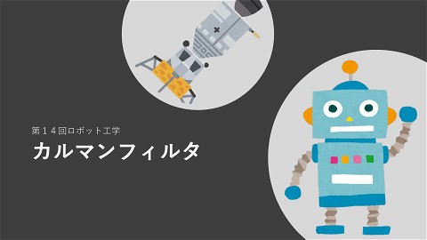
距離センサを機体で回すことによって2次元Liderと同じように地図と照合して自己位置を空いているすモンテカルロローカリセーションを実現しようというお話です。
■ドローンやロボットを自作することを通じて制御や関連技術の生涯勉強情報を提供■工学博士■防大航空宇宙→筑波大博士■陸自→対戦車誘導弾等の装備品開発→高専教員→大学教員■ロボットランサー優勝→マイクロマウスニューテクノロジー賞受賞■指導者としてつくばチャレンジバンナム賞→飛行ロボコンマルチコプタ部門1位等々■北海道函館出身
関連スライド
StampFlyで学ぶマルチコプタ制御
2025StampFly勉強会
各ページのテキスト
Localization using uni-axial laser rangefinder and IMU for MAV
Introduction
UAV and MAV ● In recent years, research on Unmanned Aerial vehicles (UAV) and Micro aerial vehicles (MAV) has become more popular. Introduction 3
Localization ①Scanning the environment ②Matching the point cloud data to the map ③Localization Point cloud data Scanning Matching map and point cloud sata Map Introduction 4
Laser scanner Hokuyo UTM-30LX 210g Velodyne HDL-64e 13kg Introduction SICK LMS210 4.5kg 5
Size and Weight 30cm 1.3kg Introduction 6
Laser scanner Hokuyo UTM-30LX 210g Velodyne HDL-64e 13kg Introduction SICK LMS210 4.5kg 7
Purpose UAV Localization using rotation UAV miniaturization and weight reduction Introduction
MAV System 9
Equipment MAV System 10
System Uniaxial LRF 12V Supply 22.2V Battery USB USB Wifi Navigation USB Auto pilot APM2.6 BeagleBoard-xM ESC ESC ESC ESC Motor モータ モータ モータ 5V Supply MAV System 11
Attitude and Vertical control ● PID Attitude Control system Pitch/Roll Varying left/right thrust causes angular velocity Yaw One pair CW One pair CCW Vertical Up Gravity Difference of thrust causes pitch/roll rate Difference of yaw moment causes rotation Move forward/backward Down Gravity Control 12
Localization 13
Monte Carlo Localization Step 1 Step 2 Likelihood update Initial distribution Compare robot's environment with particles' environment Particles Robot Step 3 Resampling and Position estimation Resample particles by their likelihood to estimate robot's position Step 4 Motion prediction All particle move according to a probabilistic motion model Return to Step 2 14
Monte Carlo Localization Localization 15
Quadrotor motion model 2 x k +1=0.5 a x Δ t +v x Δ t + x k k 2 y k +1 =0.5 a y Δ t +v y Δ t + y k v x =a x Δ t +v x v y =a y Δ t +v y ψk +1= p Δ t + ψk k k +1 k k k +1 k k Position, Velocity and Yaw angle x k , y k , v x ,v y , ψk Control a x , a y , r (Yaw rate) k k Localization 16
Measurement model (A) (B) (C) (D) Measurement model = A + B + C + D Localization 17
Scanning by Maneuver Set distance between each point ● Rotation at each point ● Fixed UAV altitude ● Rotation points Localization 18
Experiment 19
Experiment environment Created using UTM-30LX Experiments 20
Simulation result Initial Particle distribution Resampling after UAV rotation Success estimation Movement without rotation resulted in expansion of particle distribution 21
Simulation 22
Experimental Result 23
Conclusion and Future work ● ● ● ● We achieved successful localization using a uniaxial laser rangefinder by applying Monte Carlo Localization. In order to self-localize, the UAV has to rotate. We will next add equipment to mechanically obtain the UAV`s true position to acquire a more accurate comparison between the experimental and theoretical results. We will strive to achieve autonomous flight where the UAV will decide the best actions by itself. 24